# What is TransparentMAPS
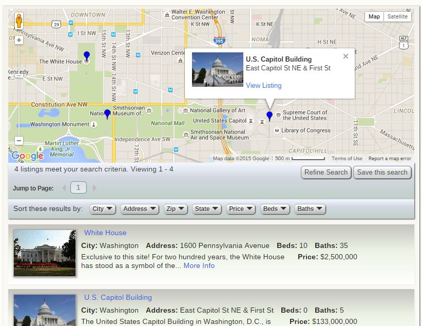
TransparentMAPS™ (TMAPS) is an add-on for Open-Realty® (OR) that uses the Google Maps API to embed maps into its various pages to display the locations of listings. The maps are positioned and embedded using OR template tags specific to TMAPS which are fully configurable via: TransparentMAPS Configuration
Google's mapping service requires accurate Longitude and Latitude coordinates to display accurate maps, these coordinates can either be entered for your listings manually when you create or edit them, or you can optionally use a 3rd party geocoding service, and TransparentMaps will automatically obtain and insert the coordinates for you.

Features summary:
- Search Results Map - Embed a map to display marker icons (pins) identifying the location of each listing returned on the search results page.
- Listing Show Map - Embed a map on the listing detail page to identify the location of that specific listing.
- Listings in the area - Embed a map on the listing detail page to identify the location of other listings within a pre-configured distance from the listing being viewed.
- Agent Listings Map - Embed a map on the Agent detail page to identify the location of that Agent's listings.
- Fully Configurable - Configuring TMAPS is similar to using Open-Realty's Site Configuration. It provides for changes to the layout and fields displayed in the Map's info window, the size of embedded maps, as well as if a map should be linked to a popup window or be an integrated part of the page being displayed.
- Colored marker icons (map pins) defined by property class:


 Marker
icon colors are displayed corrosponding to the property class ID#
the listing belongs to. Marker icons for up to 25 property classes
are included.
 - Geocoding of listings* - When listings are to be displayed on the map they are checked for lat/long data, if the listing does not have lat/long data available, TMAPS will attempt to obtain Lat/Long coordinates using the listing's street address and any returned coordinates will be stored in the listing database to ensure the accurate display of maps that involve that listing in the future.
- Geocode all listings* - A function that can be triggered using a server CRON job to geocode any listings that do not contain lat/long coordinates in the listing database. It can also be manually triggered from your Open-Realty administration area. Only retrieves geocoding coordinates for listings that are missing Lat/Long information, so you can manually correct any invalid coordinates without your changes being overwritten.
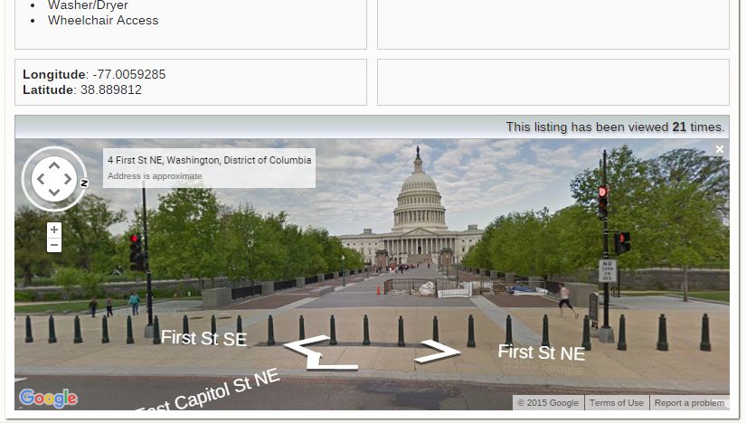
- Street View Support** -
 Optionally
display Google Street Views within your map.

- Direction Finding Support - Provide site visitors the ability to find directions to or from a property.
*Geocoding features assume you have access to a 3rd party geocoder (free or paid) such as the Google Maps Geocoding API.
Geocoding from street addresses cannot always be performed successfully, incomplete street addresses, new construction addresses or rural areas cannot always be located via geocoding services. Manual entry of Lat/Long coordinates may be necessary for some listings.
** Google has not yet captured images from each and every location accessible by street... yet.
